The Grey Zone
Planning in the Anthropocene*.
In 2015, there were a mere five concentrations of population which exceed 250 million people. Existing concentrations will continue to expand, while other concentrations, especially in the Global South, will quickly exceed this mark.
The planetary urban networks which influence the daily lives of almost of all of the world’s billions of people are far reaching, complex systems allowing for the flows of people, ideas, and capital. However, there are locations where these networks coalesce and tighten, forming megaclusters, spatial regions of hyper agglomeration and concentration of population, which attract greater and greater migration and expansion. It is in these megaclusters where individual cities meld together and local boundaries loose their relevance. In 2015, there were a mere five concentrations of population which exceeded 250 million people which are clearly visible through NASA’s night light satellite image of the globe. Over the coming years, the number of global megaclusters will increase. In 2008, it was pronounced that half the world has been tallied as living in 44 cities. This notion quickly become a popular mantra. However, this statistic is completely dependent on a multitude of arbitrary ways of defining cities. In their simplicity, these blurry global megaclusters, are perhaps more revealing, as by our rough estimation, about half the world’s population in 2015 now lives within their many nodes. It is precisely this roughness that makes megaclusters a power concept, alluding to a potent urban reality without rigid delineations.

NASA’s famous night-light rendering perfectly illustrates the contemporary notion of a metropolitan dominance. Without concerted planning, cities have grown to form an impressive constellation pulsating over the globe along vast corridors running across land, sea and skies. However, there is much this image inadvertently obscures. Although a clear indication of human activity, many brightly lit areas, such as harbors, data centers and industrial zones*, barely account for substantial habitation. Conversely, somewhere in between these bright stellar networks the vast dark regions on the map accommodate the other 3.5 billion people of the world pop- ulation. This other half is not finely dispersed over the natural hinterland living nomadic lifestyles. Instead, its population is largely settled in a fog of millions of towns and villages, simply too faint to be observed by this variety of satellite imaging, and often too small to be classified as a city. These millions of settlements are an increasingly critical part of the global economic engines (Sassen, Taylor, et al.). Unlike the hard black and white division that this satellite image suggests, the urban condition has become

--
THE GREY ZONE*
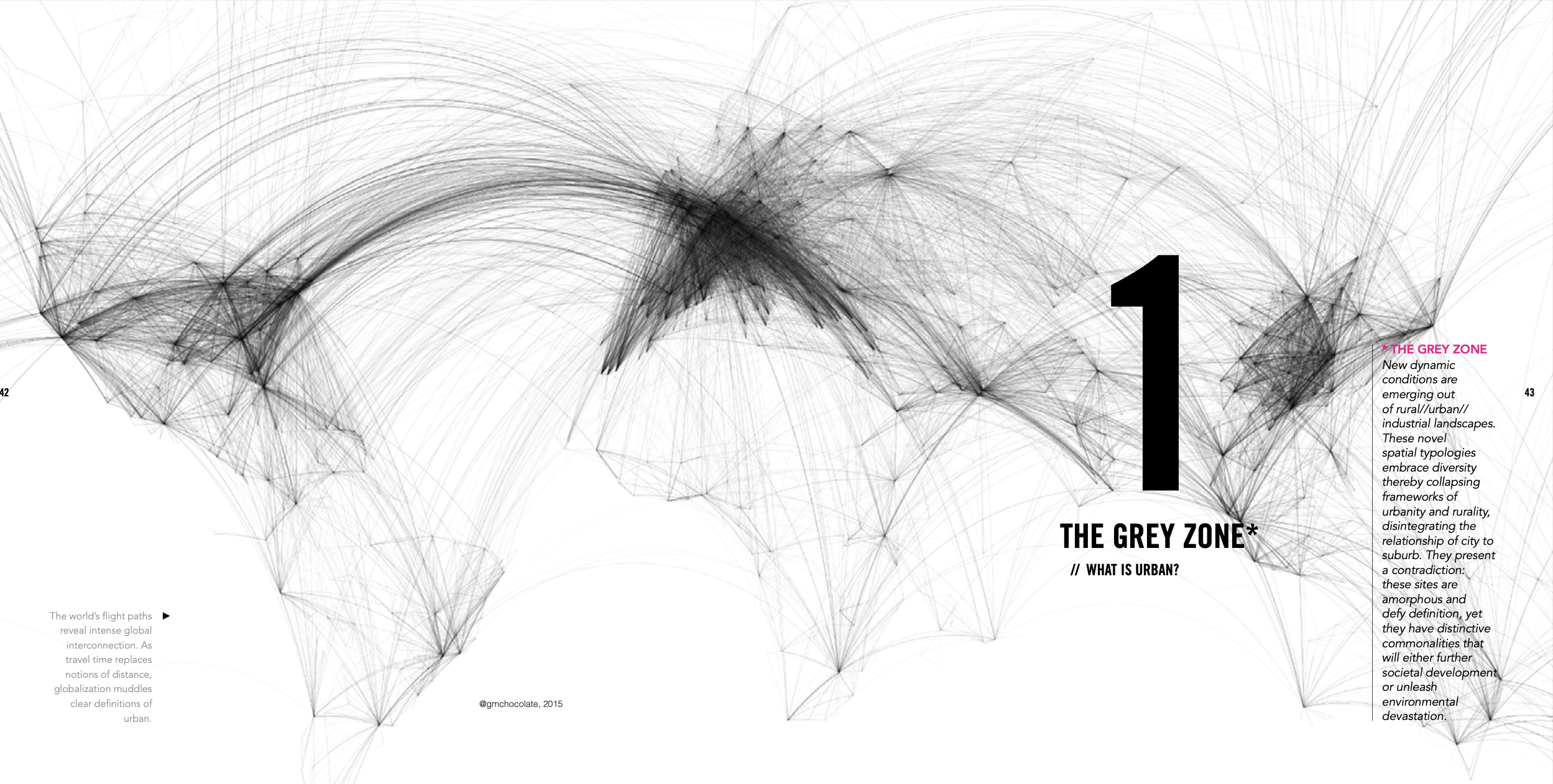
New dynamic conditions are emerging out of industrialised landscapes. These novel spatial typologies embrace diversity thereby collapsing frameworks of urbanity and rurality, disintegrating the relationship of city to suburb. They present a contradiction: these sites are amorphous and defy definition, yet they have distinctive commonalities that will either further societal development or unleash environmental devastation.
Owned by neville mars / Added by neville mars / 12.4 years ago / 1102 hits / 2 hours view time
Tags
Latest Entries
-
Asia Cluster
-
grey zone flight paths
-
morph
-
The Urbanization Policy Change and Its Raminifications to Urban Landscape
-
The Urbanization Policy Change and Its Raminifications to Urban Landscape
-
From Taobao Villages (TBV) to Taobao Towns (TBT)
Contribute
Login to post an entry to this node.
